Bonneville Dam Historic District (Boundary Increase)
Dam on the Columbia River in Bonneville, Oregon. Added to the National Register in 1987, and a National Historic Landmark.
.jpg/960px-Historic_Columbia_River_Highway_-_Bonneville_Dam_Historic_District_-_Fish_Ladder_(1).jpg)
.jpg/960px-Historic_Columbia_River_Highway_-_Bonneville_Dam_Historic_District_-_Fish_Ladder_(2).jpg)

.jpg/960px-Historic_Columbia_River_Highway_-_Bonneville_Dam_Historic_District_-_Hatchery_(1).jpg)
What it is
Bonneville Lock and Dam consists of several run-of-the-river dam structures that together complete a span of the Columbia River between the U.S. states of Oregon and Washington at River Mile 146.1. The dam is located 40 miles (64 km) east of Portland, Oregon, in the Columbia River Gorge. The primary functions of Bonneville Lock and Dam are electrical power generation and river navigation. The dam was built and is managed by the United States Army Corps of Engineers. At the time of its construction in the 1930s it was the largest water impoundment project of its type in the nation, able to withstand flooding on an unprecedented scale. Electrical power generated at Bonneville is distributed by the Bonneville Power Administration. Bonneville Dam was named after an adjacent railway station, which in turn was named for United States Army Captain Benjamin Bonneville, an early explorer and fur trader, who never came close to the site. The Bonneville Dam Historic District was designated a National Historic Landmark District in 1987.
Text from Wikipedia, CC BY-SA 4.0.
The record
| Property type | Historic district |
| Address | Roughly bounded by Mitchell Creek Bypass, SW District boundary, Union Pacific right-of-way, and Hatchery Service Rd., Bonneville, OR |
| County | Multnomah County |
| Listed | Mar 26, 1987 |
| Listed for | Conservation, Education, Politics and government, Architecture |
| Level of significance | National |
| Also known as | Bonneville Hatchery; Central Hatchery; See Also:Bonneville Dam |
| Reference number | 86003598 |
| Type of place | historic district |
| Designations | National Historic Landmark |
| Contributing resources | 2 buildings |
| Standing | Yes |
The nomination form, the document that argues why this place matters, is in the National Archives: Read the nomination ↗
Visiting
| Address | Roughly bounded by Mitchell Creek Bypass, SW District boundary, Union Pacific right-of-way, and Hatchery Service Rd., Bonneville, OR |
| Coordinates | 45.6340° N, 121.9553° W · Directions ↗ |
| Nearest national park unit | Fort Vancouver National Historic Site · 34 miles · on Park Atlas |
| Federal campgrounds nearby | Eagle Creek Overlook Grp Site 1 mile · Eagle Creek Campground 2 miles · Herman Creek Campground/Horse Camp 6 miles |
Explore
Map
Nearby in Multnomah County


Public land around it
| Mark O. Hatfield Wilderness ↗Wilderness, U.S. Forest Service | Inside the boundary65,435 acres |
Wilderness Atlas publishes a centroid and an acreage for each unit, not a boundary line. Distance here is measured to a circle of the same area drawn around that centroid, so treat it as roughly right rather than surveyed.
Local history books for Multnomah County
We earn a small commission if you buy through these links. It does not change what we list.
- Murder & Scandal in Prohibition PortlandJD Chandler and Theresa Griffin Kennedy, 2016Find at Bookshop.org
Guidebooks to historic places and travel in Oregon

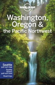
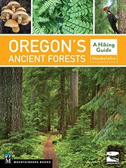
Titles come from Open Library's catalog, matched by subject heading or by title.
Reference
Questions people ask
When was Bonneville Dam Historic District (Boundary Increase) listed on the National Register?
Mar 26, 1987. It is also a National Historic Landmark, the higher of the two designations.
Source: National Park Service
Where is Bonneville Dam Historic District (Boundary Increase)?
Roughly bounded by Mitchell Creek Bypass, SW District boundary, Union Pacific right-of-way, and Hatchery Service Rd., Bonneville, Multnomah County, Oregon. The nearest national park unit is Fort Vancouver National Historic Site, 34 miles away.
What does the Bonneville Dam Historic District (Boundary Increase) listing include?
The listing counts 2 contributing resources. Those are 2 buildings. A contributing resource is a part of the listed property that carries its historic significance.
Source: National Park Service
Where is the nomination form for Bonneville Dam Historic District (Boundary Increase)?
The National Archives holds the nomination form, the document that made the case for listing.
Source: National Archives
Are there campgrounds near Bonneville Dam Historic District (Boundary Increase)?
Three federal campgrounds are within reach. The closest is Eagle Creek Overlook Grp Site, 1 mile away. Eagle Creek Campground is 2 miles away, and Herman Creek Campground/Horse Camp is 6 miles away.
Source: Campsite Atlas
Is there cell service at Bonneville Dam Historic District (Boundary Increase)?
FCC coverage maps show Verizon 4G LTE, AT&T 5G, and T-Mobile 5G at the listed point. Coverage indoors and behind old masonry is another matter.
Source: FCC Broadband Map
Is there a wildfire near Bonneville Dam Historic District (Boundary Increase) right now?
4 active incidents within 50 miles as of 2026-10-17, nearest Top Of The World Rx, 27 miles away.
Source: Map
Sources
Location, type and contributing counts come from the National Park Service's National Register spatial data. Listing dates come from the National Register office's spreadsheet where it carries the listing. Construction date, architect, style, photograph and encyclopedia link come from Wikidata and Wikimedia Commons, matched on reference number 86003598. Nothing here is transcribed by hand. The nomination form and photographs ↗ at NPGallery are the original nomination as filed with the National Park Service, and the form is often the best description of the place. The description under "What it is" is the opening of the Wikipedia article, CC BY-SA.