Walking tours of Philadelphia
More of the dated building in Philadelphia went up in the 1920s than in any other decade. Schools make up the largest group by what the buildings were for.
6 themed routes run through those listings. Of the routes below, one follows a single style, four follow one kind of building and one follows a single decade. A subject becomes a route only where the register holds enough of it close enough together to walk.
Every listing in Philadelphia → · 632 in all
The routes
- StyleRenaissance Revival architecture in Philadelphia10 stops · 2.5 miles · stops last changed Oct 16, 2026Renaissance Revival draws on the Italian palazzo, with a rusticated ground floor, round arched windows and a strong horizontal cornice. The Philadelphia examples on this route went up between 1805 and 1904.
- Building typeBanks and business blocks in Philadelphia10 stops · 1.7 miles · stops last changed Oct 16, 2026The route links commercial buildings built between 1795 and 1893. Most were built to hold shops at street level and offices above.
- Building typeHouses and mansions in Philadelphia15 stops · 2.1 miles · stops last changed Oct 17, 2026The route links houses built between 1870 and 1928. Many are private homes and the stops are meant to be seen from the sidewalk.
- Building typeSchools and libraries in Philadelphia11 stops · 2.2 miles · stops last changed Oct 16, 2026The route links schools built between 1857 and 1987. Some are still in use for teaching and some have been converted to other work.
- Building typeIndustry and warehouses in Philadelphia10 stops · 2.5 miles · stops last changed Sep 24, 2026The route links industrial buildings built between 1882 and 1905. Many have been converted to other uses since they were listed.
- Decade builtPhiladelphia in the 1920s10 stops · 2.3 miles · stops last changed Sep 18, 2026Every stop carries a construction date in the 1920s. They are what Philadelphia holds on the register from that decade.
Every route holds at least ten stops and stays under two and a half miles. Routes are computed from the coordinates in the National Park Service National Register spatial data or, where it has no point, Wikidata, and the distances are straight lines between stops. Listings with a restricted address in the Register are never mapped and never become stops. Data refreshed November 02, 2026.
Local history books for Philadelphia
We earn a small commission if you buy through these links. It does not change what we list.
Guidebooks to historic places in Pennsylvania
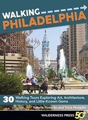
Titles come from Open Library's catalog, matched by subject heading or by title.