Columbia River Highway Historic District
Highway in Oregon. Added to the National Register in 1983, and a National Historic Landmark.
.jpg/960px-%22Columbia_River_from_Crown_Point%22%2C_Oregon%2C_c1916_(11794815443).jpg)

_(cropped).jpg/960px-1916_advertisement_%22Union_Pacific_System%22_%22Summer_Vacation_Fares_to_the_Great_Pacific_Northwest_Oregon_Washington%22_in_the_Boston_Evening_Transcript_on_April_25%2C_1916_(page_20)_(cropped).jpg)

What it is
The Historic Columbia River Highway is an approximately 75-mile-long (121 km) scenic highway in the U.S. state of Oregon between Troutdale and The Dalles, built through the Columbia River Gorge between 1913 and 1922. As the first planned scenic roadway in the United States, it has been recognized in numerous ways, including being listed on the National Register of Historic Places, being designated as a National Historic Landmark by the U.S. Secretary of the Interior, being designated as a National Historic Civil Engineering Landmark by the American Society of Civil Engineers, and being considered a "destination unto itself" as an All-American Road by the U.S. Secretary of Transportation. The historic roadway was bypassed by the present Columbia River Highway No. 2 from the 1930s to the 1950s, leaving behind the old two-lane road. The road is now mostly owned and maintained by the state through the Oregon Department of Transportation (ODOT) as the Historic Columbia River Highway No. 100 or the Oregon Parks and Recreation Department as the Historic Columbia River Highway State Trail.
Text from Wikipedia, CC BY-SA 4.0.
The record
| Property type | Historic district |
| Address | Roughly bounded by the Sandy River Bridge, Troutdale, Multnomah County on the West, the Chenoweth Creek Bridge, etc., Troutdale, OR |
| County | Multnomah County |
| Listed | Dec 12, 1983 |
| Listed for | Engineering, Transportation |
| Level of significance | National |
| Reference number | 83004168 |
| Type of place | road |
| Designations | National Historic Landmark, Historic Civil Engineering Landmark |
| Contributing resources | 38 structures |
| Standing | Yes |
The nomination form, the document that argues why this place matters, is in the National Archives: Read the nomination ↗
Visiting
| Address | Roughly bounded by the Sandy River Bridge, Troutdale, Multnomah County on the West, the Chenoweth Creek Bridge, etc., Troutdale, OR |
| Coordinates | 45.6679° N, 121.2409° W · Directions ↗ |
| Nearest national park unit | Fort Vancouver National Historic Site · 69 miles · on Park Atlas |
| Federal campgrounds nearby | Knebal Springs Campground/Day Use 20 miles · Eightmile Campground/Day Use 21 miles · Moss Creek Campground 21 miles |
Explore
Map
Nearby in Multnomah County


Local history books for Multnomah County
We earn a small commission if you buy through these links. It does not change what we list.
- Murder & Scandal in Prohibition PortlandJD Chandler and Theresa Griffin Kennedy, 2016Find at Bookshop.org
Guidebooks to historic places and travel in Oregon

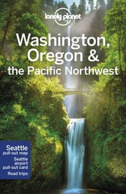
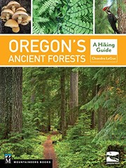
Titles come from Open Library's catalog, matched by subject heading or by title.
Reference
Questions people ask
When was Columbia River Highway Historic District listed on the National Register?
Dec 12, 1983. It is also a National Historic Landmark, the higher of the two designations.
Source: National Park Service
Where is Columbia River Highway Historic District?
Roughly bounded by the Sandy River Bridge, Troutdale, Multnomah County on the West, the Chenoweth Creek Bridge, etc., Troutdale, Multnomah County, Oregon. The nearest national park unit is Fort Vancouver National Historic Site, 69 miles away.
What does the Columbia River Highway Historic District listing include?
The listing counts 38 contributing resources. Those are 38 structures. A contributing resource is a part of the listed property that carries its historic significance.
Source: National Park Service
Where is the nomination form for Columbia River Highway Historic District?
The National Archives holds the nomination form, the document that made the case for listing.
Source: National Archives
Are there campgrounds near Columbia River Highway Historic District?
Three federal campgrounds are within reach. The closest is Knebal Springs Campground/Day Use, 20 miles away. Eightmile Campground/Day Use is 21 miles away, and Moss Creek Campground is 21 miles away.
Source: Campsite Atlas
Is there a wildfire near Columbia River Highway Historic District right now?
2 active incidents within 50 miles as of 2026-10-10, nearest Grasshopper, 31 miles away.
Source: Map
Sources
Location, dates, type and contributing counts come from the National Park Service's National Register spatial data. Construction date, architect, style, photograph and encyclopedia link come from Wikidata and Wikimedia Commons, matched on reference number 83004168. Nothing here is transcribed by hand. The nomination form and photographs ↗ at NPGallery are the original nomination as filed with the National Park Service, and the form is often the best description of the place. The description under "What it is" is the opening of the Wikipedia article, CC BY-SA.